By Cathy Jones (2008, 2024)
The Strathfield Town Centre is located near the Strathfield Railway Station. This history concerns the area of the Town Centre on the southern side of the railway, under the control of Strathfield Council. However, it is acknowledged that parts of the Town Centre are also located in the City of Canada Bay and Burwood Council areas.
The earliest development in the Strathfield Town Centre were houses built from the 1870s, augmented by rail access to the City from 1876. In the 1920s Strathfield Rail Station was redeveloped and expanded into one of Sydney’s largest rail stations. Throughout its history, the Strathfield Town Centre has evolved to meet changing needs for access to transport, housing, employment, shops and services.
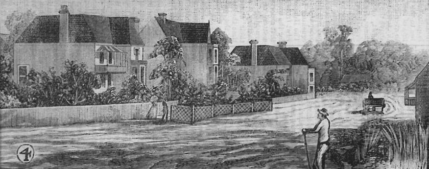
The first Sydney passenger railway line opened in 1855 between Sydney and Parramatta, with stations at Burwood and Homebush. The land now occupied by the current Strathfield Town Centre were empty paddocks, part of the 1799 Thomas Rowley land grant. Powells Creek passed through the land from south-east to north-west. The railway line provided a northern boundary. By 1874 ownership of the land passed to the ownership of Randolph Nott, an architect, financier, agent and former Member of NSW Parliament. Nott’s own house ‘Silwood’ was located on The Boulevarde close to the railway line. He sold sites on The Boulevarde bordered by Redmyre Road to wealthy merchants, who built two storey mansions such as ‘Clareinnis’, ‘Walthamstow’ and ‘Presteign’ by 1880.
The residential growth of Strathfield and especially those residences in or near the Strathfield Town Centre were supported by access to railway system. In 1876, halt was established at Strathfield (then called Redmyre) where trains could be flagged down. In 1877, platforms were built and a railway station was established with scheduled stops.
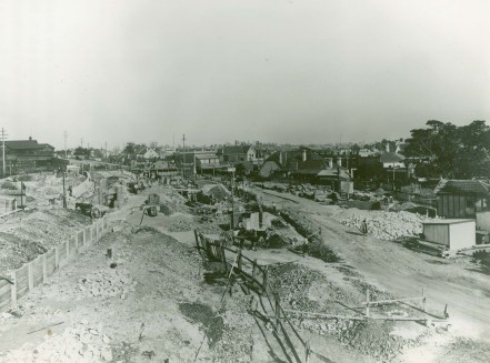
In 1926-1927, the Strathfield rail station was completely demolished and a new rail station built. In October 1926, the Railway Department closed Bridge Road, which was position over the railway between The Boulevarde and Everton Road. A new subway road underpass was built to link the approach roads leading from Mosley and Cooper Streets on the north, and from Clarendon Road (now Albert Road) on the south. A road linking The Avenue (now Churchill Avenue) and Clarendon Road was opened (now called Raw Square). A pedestrian subway was built under the railway linking The Boulevarde to Everton Road.
The first developments in the Strathfield Town Centre were not shops but large Victorian mansions. In the period of 1870-1890, a number of large houses were built along The Boulevarde close to Strathfield Station. These included: ‘Silwood‘ built 1878 home of financier and architect Randolph Nott (who owned most of the land around Strathfield Station), ‘Walthamstowe’ built 1878 home of ironmonger Cornelius Edwards and later William Beaumont, ‘Presteign’ built 1880 (located on corner of The Boulevarde and Churchill Avenue) was the home of William Beaumont. ‘Clareinnis’, located near the corner of Redmyre Road and The Boulevarde was the home of David Buchannan, Member of NSW Parliament.
A few shops were built c.1890 on The Boulevarde near Redmyre Road. These shops are two storey and Victorian in style. ‘Keary’s Corner’ is located on the corner of Redmyre Road and The Boulevarde and was a famous historical-style sweet shop for over 60 years. In order to expand Strathfield Station in the 1920s, the Commissioner of Railways compulsory acquired properties located close to the railway, which included the Victorian mansion houses such as ‘Silwood’ and ‘Walhamstowe’. The mansions that remained disappeared from streetview as shops were built in their front yards facing The Boulevarde and Churchill Avenue from the 1920s.
Records including Sands Sydney Directory and Strathfield Council’s Register of Miscellaneous Licences record that this group of shops have regularly had changes of use including milk bars, banks, restaurants, hairdressers, real estate agents and clothing shops. Frances Pollen’s ‘Shopkeepers and Shoppers’, 1989 [p228-230] contain a short article on Strathfield’s shops with particular focus on the shop ‘Dunlops’, a local drapers and mercers store. Though this store has since closed, an old Dunlops sign is still visible on the rear of the shop in Orr’s Lane.
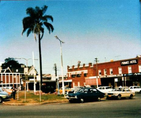
Shops in the Strathfield Town Centre primarily provided local shopping and services. The first arcade, the Symonds Arcade on Churchill Avenue, was built in 1963. Strathfield’s largest shopping centre, Strathfield Plaza, was opened in 1981. Both developments involved the demolition of older houses. The Strathfield Plaza development also included the Town Centre’s first high rise units and office block. A number of high rise developments were built in 1994-1996 including ‘Sandalwood’ (5-7 Albert Rd), ‘Regal Court’ 15-19 Churchill Avenue and 12-18 Albert Road and 7-9 Churchill Avenue.
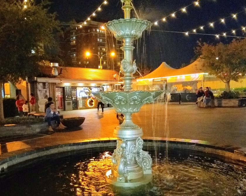
The land on which Strathfield Square is built was acquired in the 1920s when the railway was redeveloped. The Square formerly featured a small grass island in the centre of roadways. In 1988, the Square was redeveloped into a pedestrian plaza featuring trees and seating, with reduced road access. The Square was refurbished in 2016-2017 with new paving and lighting.
The major changes to the Strathfield Town Centre post-1900 are as follows:
1909: ‘Silwood’ was compulsorily acquired by NSW Railway Department for projected changes to the Strathfield Railway Station. The Department of Railways leased the house to private occupants until the house was demolished in the 1920s for significant railway alterations.
1920s – ‘Silwood’ and ‘Walthamstowe’ demolished and in 1927, the Strathfield Railway Station was considerably expanded. The old station was completely demolished and a new station with four island platforms was constructed. The development consumed sections of Clarendon Street (now known as Albert Road), The Boulevarde and the whole of the homes ‘Silwood’ and ‘Walthamstowe’ to a depth of about 200 feet. Clarendon Road was re-routed diagonally to The Boulevarde and Strathfield Square was formed.
1920s – Land not required for the railway expansion was purchased by Strathfield Council. This land became Strathfield Square. A small grass park was located in the middle of the Square surrounded by the roads: Albert Road, The Boulevarde and Churchill Avenue (then known as The Avenue).
1920s – The house ‘Presteign’ was sold. Shops and offices were built in the front of the building, along the frontages of The Boulevarde and Churchill Avenue. The house was converted into a private hotel. The house was obscured by the shops and offices built in front of the house.
1980s – Strathfield Square was redeveloped. The grass park was replaced by a pedestrian plaza which was designed to facilitate pedestrian movement and limit vehicle access.
1980s – Strathfield Council sold the Council car park facing Redmyre Road to facilitate the building of Strathfield Plaza which faces Churchill Ave, The Boulevarde and Redmyre Road. The house ‘Clareinnis’ and a petrol station on the corner of Redmyre Road and Orr’s Lane was also demolished for this project. The Strathfield Plaza development was completed in 1981 and was part of a larger commercial development, which included building of the Strathfield Plaza shopping centre and residential tower and office tower. The residential development was the first multi unit ‘high rise’ development built in Strathfield Local Government Area. This development was 17 stories in height and included 129 x 2 bedroom units.
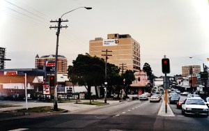
1990s – Using the height limits established by the Strathfield Plaza development, additional high rise unit developments were built in the Strathfield Town Centre along Albert and Churchill Avenues. Redevelopment of these sites involved the demolition of single storey homes along Churchill Avenue and shops along Albert Road including the Strathfield Hotel.
2016-2017 – Strathfield Square upgraded with new paving, furniture and lighting.
References
Department of Valuer-General, Municipality of Strathfield, Valuation Lists
Malcolm S ‘Old Homes in Strathfield’, Strathfield District Historical Society Newsletter Vol.5 No. 4, March 1983
NSW Land Register
Sands Sydney Directory published by John Sands 1881-1932
Wise’s Post Office Directory
© Cathy Jones 2008, 2024 (updated)

“Redevelopment of these sites involved the demolition of single storey homes along Churchill Avenue and shops along Albert Road including the Strathfield Hotel.”
The Strathfield Hotel is on Everton Road and untouched by redevelopment.
LikeLike
There is a hotel in Everton Street, which was originally known as Arditto’s Family Hotel. I haven’t notes with me but recall it was built c.1894. However, there was a motel in Albert Road. It was about six stories and built around 1960s. The original Strathfield Car Radio was adjacent to the site. I think Strathfield Library has a photo. These sites have been redeveloped.
Cathy
LikeLike
That was my great grandfather Angelo Arditto’s hotel :-)
LikeLike
Hi — I would like to seek out the photo of the’ Motel’ in Albert Road. I have no recollection of ever seeing this.
LikeLike
Yes the Motel style building existed – hard to believe. Next to LJ Hookers real estate on the corner as you go up Albert Rd on the left.
LikeLike
Great read thankks
LikeLike