A page has been set up on Coronation Parade. Street pages contain links to pages related to the particular location. There are nearly 600 pages, 250 posts with over 1100 comments on this site, so this is the simplest way of presenting information.
Coronation Parade is one this district’s major roads running from Liverpool Road at north to Punchbowl Road at its southern end. It has major historical significance to the Strathfield, Enfield and Burwood areas, including:
- being the division between the historical Redmire Estate and ‘Faithfull’s Farm’, which is today’s boundary between Strathfield and Burwood Municipalities
- being the site of St Thomas Anglican Church, the oldest building in the Strathfield, Enfield and Burwood areas. St Thomas is celebrating its 175th anniversary this year (and this will be the subject of an upcoming post)
- the former route of the Enfield to Mortlake/Cabarita tram Service
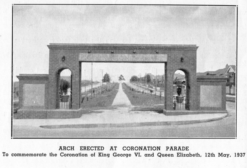
- the Coronation Arch built in 1937 to commemorate the Coronation of King George VI (noting another Coronation in 2023 of King Charles)
- Enfield War Memorial and the former Enfield Council Chambers.
- and much more
Coronation Parade also features Coronation Reserve, a large area of park and open space running the entire length of the roadway. It measures over 15,000 square metres. This area is actually a road reserve and its maintenance is shared between Strathfield and Burwood Councils. The presence of an extensive area of green space in an urban area, adjacent to a major roadway is rare in Sydney.
An article on 101 Coronation Parade, a federation house which is heritage listed has also been added to the site. More local histories will be added to the site (time permitting).
As usual any comments, additions, amendments, suggestions or donations of photos or information are welcome.
Additional reading:
Former Enfield Council Chambers
St Thomas Anglican Church and Cemetery
Discover more from Strathfield Heritage
Subscribe to get the latest posts sent to your email.
